Geographic Information Systems in their advanced form originated in late 90’s. During this time Remote Sensing has become operational to provide basic information required for natural resources evaluation and environmental management. Remote sensing technology has played an important role in affective mapping and monitoring of the natural resources and environment. GIS emerged as a specialized tool for scientists and city planners, providing various types of geographic information to an enthusiastic web based clients.
In this context, Jawaharlal Nehru Technological University Kakinada (JNTUK) initiated to acquire appropriate expertise and would like to be in the forefront in human resource development, research and consultancy.
School of Spatial Information Technology (SSIT) is an on-campus School, constituent of Institute of Science and Technology (IST), JNTUK, Kakinada, commissioned in the year 2009 and has been successfully working for the development of Academic advancements and Research perusal.The School offers academic program in Post Graduate leading to M.Tech in Remote Sensing.
JNTUK, offers Ph.D. (External) in Spatial Information Technology in correspondence with the School of Spatial Information Technology, and since 2012 department had been supporting 13 research scholars under the guidance of Professors from the University as internal supervisor and many eminent Academician/Scientist as external supervisor.
All of the core, additional and elective courses included in the programs have been specifically designed to meet industry standards and research requirements. The close links that the department enjoys with the industry and research organizations, has worked towards elevating the level and quality of studies and facilities. The department also works towards building the social and moral character of the students.
The course is not only going to provide job opportunity for the young students but shall also open an avenue of effective and viable interaction with national establishments related to various aspects of remote sensing. The course aims at developing multidimensional programmes of teaching and research in the field of Remote Sensing and GIS.

| # | Title | File |
|---|---|---|
| 1 | M.Tech- Remote Sensing (R19) Course structure | View PDF |
| S.No | Publication Name | Impact Factor | Description |
|---|---|---|---|
| 1 | International Journal |
P. Sridhar, A. S. Chandra Bose, K. Padma Kumari, and K. Srinivasa Reddy, (2012). “Identification and Priority of Sub-Watersheds for Soil Conservation Measures, Based on Sediment Yield Index, Using GIS tool: Kadam Watershed of Adilabad District, India.” Vol. 30 (Issue 3C), pp 1122-1127, Environment and Ecology |
|
| 2 | National Conference |
K. Padma Kumari, Killi Srinivas, and V Gopi Krishna Kasyap, “Shoreline change analysis of erosion and deposition using Landsat Data 2000 & 2015 in the coastal part of East Godavari District, Andhra Pradesh, India,” pp.111-123, Proceedings of Two day National Workshop on Coastal Erosion & Environmental Challenges (CEEC), UCEK(A), JNTUK, Kakinada, 2015 |
|
| 3 | National Conference |
P. Sridhar, K. Padma Kumari and K. Srinivasa Reddy, “Geo spatial based Computation of Morphometric Parameters –Kadam Reservoir Catchment Area, Adilabad district, India.” Pp 31-38, Proceedings of National Conference on Recent Advances in Geo-Science, Engineering & Technology, (NCRAGE), UCEK(A), JNTUK, Kakinada, 2012 |
|
| 4 | National Conference |
V Gopi Krishna Kasyap and K. Padma Kumari, “Customized Property Tax Assessment Toolbar based on Digital Parcel Mapping using ArcGIS” pp 117-128, Proceedings of National Conference on Recent Advances in Geo-Science, Engineering & Technology, (NCRAGE), UCEK(A), JNTUK, Kakinada, 2012 |
|
| 5 | National Conference |
K. Padma Kumari, “Geological and Geomorphological studies in part of Prakasam District, Andhra Pradesh, India, using Remote sensing Techniques” pp 181-188, Proceedings of National Conference on Recent Advances in Geo-Science, Engineering & Technology, (NCRAGE), UCEK(A), JNTUK, Kakinada, 2012 |
|
| 6 | International Conference |
G S Pratusha Kranthi, K V Rao, and K. Padma Kumari, “Drought Risk Assessment through Dryspells in Kharif season”, International Symphosium on “Advances in Agrometeorology for Managing Climate Risks of Farmers (INAGMET-2019) |
|
| 7 | National Conference |
K Padma Kumari and Ch N Vara Laxmi, “Creation of Web based Land Information System of Yeleru river sub-basin of East Godavari district, Andhra Pradesh, India, using Remote Sensing & GIS technique and .NET” pp 907-931, National Seminar on Geo-Informatics Applications in Natural Resource Management, NIRD & PR, 18-19 March, Hyderabad, Andhra Pradesh, India, 2016 |
|
| 8 | National Conference |
Sreekanthi. P, Padma Kumari. K, and Ch N Vara Laxmi, “Asset Mapping and Consumer Indexing under Restricted Accelerated Power Development and Reforms programme – A case study on Bellampalli town, Adilabad district.” pp 779-793, National Sem., on Geo-Informatics Applications in Natural Resource Management, NIRD & PR, 18-19 March, Hyderabad, Andhra Pradesh, India, 2016 |
|
| 9 | National Conference |
K Padma Kumari and K Srinivas, “Morphometric Analysis for Sub-Watersheds of Maredumilli & Rompachodavaram Mandals of East Godavari District, Andhra Pradesh using Remote Sensing (RS) And Geographical Information System (GIS)”, National Conference on Water Resources and Flood Management with Special Reference to Flood Modelling (WRFM-2016), 14th & 15th October, SVNIT, Surat, Gujarat, India, 2016 |
|
| 10 | National Conference |
B.Varaprasada Rao, K. Padma Kumari, N. Darga Kumar “COMPARATIVE STUDY ON THE EFFECT OF LIME TREATMENT ON DIFFERENT EXPANSIVE SOILS”, Indian Geotechnical Conference IGC2016, 15-17 December 2016, IIT Madras, Chennai, India |
|
| 11 | National Journal |
G S Pratusha Kranthi, K V Rao, K Padma Kumari, “DK Padma Kumari, “Daily Precipitation Concentration Index for Krishna Basin”, Indian J. Dryland Agric. Res. & Dev. 2019 34(1) : 09-14 DOI:10.5958/2231-6701.2019.00002.2 |
|
| 12 | International Conference |
Surekha Gangavarapu, K. Padma Kumari, P. Udaya Bhaskar, “Integrating Multivariate Statistical Analysis using Remote Sensing and Geographical Information System to Assess Ground Water Quality of Tallarevu Mandal , East Godavari Dist, Andhra Pradesh, India”, International Conference on Emerging Trends in Engineering Technology, sponsored by Indian Research Development (IRD), 9 -10 May, Ongole, Andhra Pradesh, 2015 |
|
| 13 | International Conference |
K. Padma Kumari, V Gopi Krishna Kasyap and Killi Srinivas, “Applications of RS and GIS techniques for Disaster studies in East Godavari District, Andhra Pradesh, India.” in World Congress on Disaster Management, WCDM-2015, 19-22 November, Visakhapatnam, 2015 |
|
| 14 | International Conference |
Surekha Gangavarapu, K. Padma Kumari and P Udaya Bhaskar, “Physio-Chemical, Statistical And Geostatistical Characterization Of Water Quality In Salinity Affected Areas Of East Godavari District, Andhra Pradesh, India.” 2nd International Conference on Science, Technology & Management (ICSTM-15), 27th September, Delhi University, New Delhi, 2015 |
|
| 15 | International Conference |
K. Padma Kumari, and K. Srinivas, “Change Detection Matrix Analysis of Land Use/ Land Cover Mapping of 11 Mandals using Remote Sensing and Geographical Information Systems in Coastal Part of East Godavari District, Andhra Pradesh, India.” 2nd International Conference on Science Technology, & Mgmt., (ICSTM-15), 27th September, Delhi University, New Delhi, 2015 |
|
| 16 | International Conference |
K. Padma Kumari and K. Srinivas, “Ground Water Quality Analysis using Spatial Distribution Technique in Geographical Information System – a Case Study of KAKINADA, East Godavari, Andhra Pradesh, India”, 5th International Science Congress, (ISC-2015), International Science Congress Association, 8-9 December, Tribhuvan University, Kathmandu, Nepal, 2015 |
|
| 17 | International Journal |
K Padma Kumari, and K. Srinivas, (2016) “Ground Water Quality Analysis using Spatial Distribution Technique in Geographical Information System – a Case Study of Kakinada, East Godavari, Andhra Pradesh, India.” Vol. 5 (ISC-2015), pp 1-5, Research Journal of Recent Sciences. |
|
| 18 | International Conference |
K. Padma Kumari, and K. Srinivas, “Application of RS & GIS for the Disaster Studies in East Godavari district, Andhra Pradesh, India”, International Conference on Remote Sesning for Disaster Management, (ICRSDM), 11-13 Oct., Visakhapatnam, 2017 |
|
| 19 | National Conference |
K. Padma Kumari, ” Mineral Wealth of Andhra Pradesh” Proceedings of 1 day Workshop Natural resources of Andhra Pradesh, UCEK(A), JNTUK, Kakinada, 2015 |
|
| 20 | International Journal | 9.782 |
Kusuma Sundara Kumar, Pinnamaneni Udaya Bhaskar and Kollipara Padma Kumari, “A Novel Approach for Prediction of Future Environmental Impacts of Urban Growth” in International Journal of Civil Engineering and Technology (IJCIET) Vol 9(4), April 2018, pp. 1208–1219. ISSN Print: 0976-6308 and ISSN Online: 0976-6316 |
| 21 | International Journal | 9.78 |
B Varaprasada Rao, Dr. K Padma Kumari, Dr. N Darga Kumar, (2018), “Geotechnical characteristics of expansive soil blended with lime, calcium chloride and fly ash: An experimental comparative evaluation”, International Journal of Civil Engineering and Technology (IJCIET), 9(10), 2018, pp. 517–523. |
| 22 | International Journal | 5.971 |
Surekha Gangavarapu, Udaya Bhaskar. Pinnamaneni, K. Padma Kumari, (2015), “Ground Water Quality Mapping of East Godavari District, Andhra Pradesh, India, using Remote sensing & Geostatistics.” ISSN:0976-3031, Vol. 6 (Issue 4), pp 3602-3608, International Journal of Recent Scientific Research (IJRSR) |
| 23 | National Journal | 5.07 |
Kusuma Sundara Kumar, Pinnamaneni. Udaya Bhaskar and Kollipara Padma Kumari, “Assessment and Mapping of Urban Heat Island using Field Data in the New Capital Region of Andhra Pradesh, India,” in Indian Journal of Science and Technology, Vol. 10(11), pp. 1-8, March 2017. DOI:10.17485/ijst/2017/v10i11/99983 |
| 24 | International Journal | 3.94 |
K. Padma Kumari, and K. Srinivas, (2015). “Change Detection Matrix Analysis of Land Use/ Land Cover Mapping of 11 Mandals using Remote Sensing and Geographical Information Systems in Coastal Part of East Godavari District, Andhra Pradesh, India.”, Vol. 4 (S.I.01), pp 790- 798, International Journal of Advance Research in Science and Engineering (IJARSE) |
| 25 | International Journal | 3.84 |
Surekha Gangavarapu, Dr. K. Padma Kumari, Dr. P. Udaya Bhaskar, (2015). “Physio-Chemical, Statistical And Geostatistical Characterization Of Water Quality In Salinity Affected Areas Of East Godavari District, Andhra Pradesh, India.” Vol. 3 (S.I.01), pp 131- 140, International Journal of Advance Technology in Engineering and Science (IJATES) |
| 26 | International Journal | 3.824 |
D. Arun Kumar, Saroj K Meher, Debananda Kanhar, and K Padma Kumari, (2016), “Unified Granular Neural Networks for Pattern Classification”, Vol. 216, pp. 109-125, Neurocomputing, Elsevier |
| 27 | International Journal | 3.782 |
B Varaprasada Rao, Dr. K Padma Kumari, Dr. N Darga Kumar, (2019), “Individual Effect of Lime, Calcium chloride and Fly ash on the Strength Behavior of Expansive Soil”, IOSR Journal of Mechanical and Civil Engineering (IOSR-JMCE), vol. 16, no. 4, 2019, pp. 66-71. |
| 28 | International Journal | 3.781 |
B Varaprasada Rao, Dr. K Padma Kumari, Dr. N Darga Kumar, (2019), “Evaluation of Compaction and Strength Behavior of Different Expansive Soils Stabilized with Lime”, IOSR Journal of Mechanical and Civil Engineering (IOSR-JMCE), vol. 16, no. 3, 2019, pp. 77-80. |
| 29 | International Journal | 3.14 |
Kusuma Sundara Kumar, Pinnamaneni. Udaya Bhaskar and Kollipara Padma Kumari, “Spatio-Temporal Dynamics of Land Cover in the New Capital Region of Andhra Pradesh, India,” in International Journal of Engineering Science and Technology (IJEST), Vol. 9 (1), pp. 1-10, Jan. 2017. ISSN : 0975-5462 |
| 30 | International Journal | 2.784 |
D. Arun Kumar, K. Padma Kumari and Saroj K Meher, (2016) “Fusion of progressive granular neural networks for the classification of online data stream”, Soft Computing – Methodologies and Application, Springer, (published online) DOI: 10.1007/s00500-018-3052-x. |
| 31 | International Journal | 2.777 |
D. Arun Kumar, Saroj K. Meher and K. Padma Kumari, “Adaptive Granular Neural Networks for Remote Sensing Image Classification” in IEEE Journal of Selected Topics in Applied Earth Observations and Remote Sensing, Vol. 11 (6), pp. 1848 – 1857, May 2018. DOI: 10.1109/JSTARS.2018.2836155 |
| 32 | International Journal | 2.367 |
D. Arun Kumar, Saroj K. Meher and K. Padma Kumari, “Fusion of progressive granular neural networks for pattern classification” in Soft Computing, Springer, Feb. 2018. DOI: 10.1007/s00500-018-3052-x |
| 33 | International Journal | 1.97 |
Kusuma Sundara Kumar, Pinnamaneni Udaya Bhaskar, and Kollipara Padma Kumari, (2016), “Emerging Urban Heat Islands in the New Capital Region of Andhra Pradesh, India – A Satellite based Evaluation”, Vol. 5 (Issue 9), ISSN 2320-0243, International Journal of Advanced Remote Sensing and GIS, Cloud Publications |
| 34 | International Journal | 1.759 |
Sridhar P, Padma Kumari K, Sreedhar Ganapuram “Assessment and Planning for Integrated River Basin Management using Remote Sensing, SWAT Model and Morphometric Analysis (Case study: Kaddam River Basin, India)” in Geocarto International, Taylor & Francis, pp. 1-61, 2019. DOI:10.1080/10106049.2018.1489420 |
| 35 | International Journal | 1.53 |
Surekha Gangavarapu, Dr. K. Padma Kumari, Dr. P. Udaya Bhaskar, (2015), “Integrating Multivariate Statistical Analysis using Remote Sensing and Geographical Information System to Assess Ground Water Quality of Tallarevu Mandal , East Godavari Dist, Andhra Pradesh, India”, ISSN(Online):2347-2812, Vol. 3 (Issue 6), pp 14-20, International Journal of Recent Advances in Engineering & Technology, (IJRAET). |
| 36 | International Journal | 1.371 |
K Vijay Prakash, Ch S Geetha Vimala, P V Nagamani, N K Baranval, Shivashankar Manche, T Preethi Latha, I V G Bhavani, Y Umamaheswara Rao, Ch S N Phanindra, K Srinivas & K Padma Kumari. Role of physical oceanography parameters in ocean’s biological response with the passage of cyclone Titli in the Bay of Bengal. J Earth Syst Sci 130, 123 (2021). https://doi.org/10.1007/s12040-021-01625-y |
| 37 | International Conference | 0.981 |
D. Arun Kumar, K. Padma Kumari and Saroj K. Meher, “Dynamic granular neural networks for remote sensing image classification” IEEE International Geoscience and Remote Sensing Symposium (IGARSS), Fort Worth, Texas, 2017, pp. 3708-3711. DOI: 10.1109/IGARSS.2017.8127804 |
| 38 | International Journal | 0.25 |
K. Sundara Kumar, P. U. Bhaskar, K. Padma Kumari, (2012). “Estimation of Land Surface Temperature to study Urban Heat Island Effect using Landsat ETM+ image.” Vol. 4 (Issue 2), pp 771-778, International Journal of Engineering Science and Technology |
| 39 | International Journal | 0.25 |
K. Padma Kumari, D. Jnaneswari, D.V. SubbaRao, and P Sridhar, (2012). “Applications of Remote Sensing and Geographical Information System Techniques on Geomorphological Mapping of Coastal Part of East Godavari District Andhra Pradesh, India.”, Vol. 4 (Issue 10), pp 4296- 4301, International Journal of Engineering Science and Technology, (IJEST). |
| 40 | International Journal | 0.21 |
K. Padma kumari, Hasmath Jahan, D. V. Subba Rao, and P Sridhar, (2012). “Shoreline morphometric change analysis using remote sensing and GIS in the coastal part of East Godavari District, Andhra Pradesh, India.”, Vol. 03(Issue 02), pp 129-136, International Journal of Civil Engineering Applications Research – IJCEAR |
| 41 | National Conference | 0.13 |
D. Arun Kumar, K. Padma Kumari and Saroj K Meher, “Progressive granular neural networks with class based granulation”, pp 1-6, IEEE INDICON conference, 16th -18th December, IISC, Bangalore, India, 2016 |
| 42 | International Journal | 0.106 |
K. Sundara Kumar, P. Udayabhaskar, K. Padmakumari, and Ch. Kannamnaidu, (2010) “Ground Water Quality Assessment of Srikakulam District of Andhra Pradesh, India, using GIS.” Vol. 5 (Issue 4), pp 495-504, International Journal of Applied Environmental Sciences |
| 43 | International Journal | 0.07 |
P. Sridhar, A. Siva Sena Reddy, and K. Padma Kumari, (2012). “Spatial Information Technologies based Integrated Spatial Water Harvest and Storage Location Model for Rainfed Watersheds. Vol. 05 (Issue 04:01), pp 872-876, International Journal of Earth Science and Engineering |
| S.No | File Name |
|---|---|
| 1 | Dr. K. Padma Kumari (Chairman) Professor & HoD, School of SIT, IST, JNTUK, Kakinada. Dr. V Srinivasulu (Member) Professor of Civil Engineering, University College of Engineering Kakinada (A), JNTUK, Kakinada. Dr. Y. R. Satyaji Rao (Member) Head of the Department, Deltaic Regional Centre National Institute of Hydrology, Siddartha Nagar, Kakinada – 03 |
| S.No | Name & Contact Details | Supervisor / Co-Supervisor | Research Domain |
|---|---|---|---|
| 1 |
Mrs. Chitikela N Vara Laxmi Regd No: 19022PSIT01 Email: lakshmichitikela@gmail.com |
Supervisor: Dr. K. Padma Kumari, HOD, SSIT, JNTUK. | Landslide Susceptibility Model |
| 2 |
Mr. Killi Srinivas Regd No: 15022PSIT01 Email: killi.srinivas@gmail.com |
Supervisor: Dr. K. Padma Kumari, HOD, SSIT, JNTUK. | Biomass Carbon Sequestration |
| 3 |
Mr. Kiran Kumar Singh Kshatriya Regd No: 15022PSIT02 Email: kkirankumarsingh@gmail.com |
Supervisor: Dr. V. Srinivasulu, Professor of Civil Engg., JNTUK | Remote Sensing & GIS |
| 4 |
Mrs. Sreekanthi Pandruvada Regd No: 14022PSIT01 Email: kanthi.211@gmail.com |
Supervisor: Dr. K. Padma Kumari, HOD, SSIT, JNTUK. | GIS for Electrical Distribution |
| 5 |
Mr. V Gopi Krishna Kasyap Regd No: 14022PSIT02 Email: kasyap@live.in |
Supervisor: Dr. K. Padma Kumari, HOD, SSIT, JNTUK. Co-Supervisor: Dr. S. Srinivas Kumar, Professor of ECE, JNTUK. |
SAR Image Processing |
| 6 |
Mrs. L Surya Kumari Vudimudi Regd No: 14022PSIT05 Email: surta.tata@gmail.com |
Supervisor: Dr. K. Padma Kumari, HOD, SSIT, JNTUK. | Digital Image Processing |
| 7 |
Mr. Madhu babu Kanaparthi Regd No: 14022PSIT04 Email: mkanaparthi@gmail.com |
Supervisor: Dr. V. Srinivasulu, Professor of Civil Engg., JNTUK Co-Supervisor: Dr. S. Srinivasa Rao, GM, RRSC-W, NRSC, Hyderabad. |
Green City |
| 8 |
Mr. Chinnam Yuvaraju Regd No: 13022SPIT01 Email: chinnamyuvraj@gmail.com |
Supervisor: Dr. Iyyanki V. Murali Krishna, DRDO, RCI, Hyderabad Co-Supervisor: Dr. K.V.S.G.Murali Krishna, Professor of Civil Engg., JNTUK |
Geospatial Epidemiology |
| 9 |
Mrs. G.S. Pratyusha Kranthi Regd No: 13022SPIT02 Email: pratyushags@yahoo.com |
Supervisor: Dr. K. Venkateswara Rao, Principle Scientist, CRIDA, Hyd. Co-Supervisor: Dr. K. Padma Kumari, HOD, SSIT, IST, JNTUK. |
Water Management |
| 10 |
Mr. Vineeth Chandan Regd No: 13022SPIT03 Email: vineet.chandan@gmail.com |
Supervisor: Dr. K. Padma Kumari, HOD, SSIT, JNTUK. Co-Supervisor: Dr. R. S. Dwivedi, Centre for Water Resources, IST, JNTUH. |
Urban Ecosystem |
B.E./ B.Tech in Geo Informatics/ Civil/ ECE/ CSE/ Agriculture Engg/ Mining/ Urban & Regional Planning/ IT (OR) M.Sc., Geology/ Applied Geology/ Geo Physics/ Geography/ Geography/ Geo Informatics/ Physics/ Maths/ Oceanography/ Environmental Science and Equivalent degree.
ELIGIBILITY FOR ADMISSIONS:
Admission to the above program shall be made subject to the eligibility, qualifications and specialization prescribed by the University from time to time.
Admissions shall be made on the basis of merit rank obtained by the qualifying candidate at an Entrance Test conducted by the University or on the basis of any other order of merit approved by the University, subject to reservations prescribed by the university from time to time.
| S.No | Advantage Description |
|---|---|
| 1 | Given the wider applications of Remote Sensing (RS) and GIS and the scarcity of human resource with the knowledge of this technology, it is appropriate to offer this course to the students so that their employability is enhanced. The fact that job opportunities for people having knowledge of Remote Sensing are available in organizations like Space Application Centre (SAC) Ahmadabad, National Remote Sensing Centre (NRSC) Hyderabad, Indian Space Research Organization (ISRO) Bangalore, Indian Institute of Remote Sensing (IIRS), Dehradun, Parliamentary House, New Delhi, Oil Natural Gas Corporation Ltd (ONGC), Agricultural Research Institute (IARI) New Delhi, Indian Council of Agricultural Research (ICAR), Ministry of Agriculture (GOI), National Institute of Rural Development (NIRD), Hyderabad, Regional Remote Sensing Centres (RRSC), State Remote Sensing Centres (RSC), and various Academic Institutions across India. Besides this, employment opportunities are available in the private sector and overseas, which further highlights the importance of the course. The demand for Remote Sensing and GIS is increasing day by day in Government and Private sectors. A Remote Sensing and GIS professional can start his/her career as Project Manager, Sr. System Executive, System Analyst, GIS Engineer, Image Analyst, GIS Programmer, etc. Many Government and Private Establishments have come up with strong collaborations for the development of RS & GIS for growth in the IT sector. Students admitted through GATE score card are eligible for AICTE scholarship (based on AICTE rules and regulations). Students admitted through PGCET Counselling are eligible (based on GoAP rules and regulations) to apply for Fee Reimbursement offered by the Government of Andhra Pradesh. Strengths:
|
| S.No | Case Study Focus Description |
|---|---|
| 1 | The work on the project shall be initiated at the beginning of the second year and the duration of the project is for two semesters (3rd & 4th semesters). A candidate shall be allowed to submit the project report only after fulfilling the attendance requirements of all the semesters with the approval of PRC and within the stipulated time prescribed by the University Authorities. For the approval of PRC, the candidate shall submit a copy of the thesis to the Director, IST, JNTUK (through the Head of the Department) and shall make an oral presentation before the PRC. Areas of interest for SIT students include Biodiversity, Coastal Zone Management, Watershed Management, Infrastructure Management, Environmental Impact Assessment, Mapping Mining Areas, and Surveys with GPS and DGPS. Students are supported to do their projects in APSRAC, NRSC, SAC, IIRS, etc. Project Statistics:
|
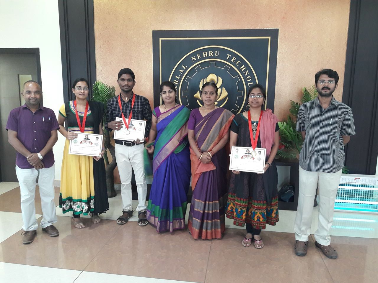
Jawaharlal Nehru Technological University (JNTUK) , Kakinada, Andhra Pradesh PIN:533003